Because reaching the crater of Mt. Pinatubo via the famous Capas trail is too mainstream, we decided to take the much longer, and more physically demanding route (via Sapang Uwak Trail).
Para maiba lang. Who would have thought, this unpopular trail offers not only a brand new experience of Mt. Pinatubo, but also a total different perspective of the crater lake. Up to this date, that view of the Pinatubo lake from the crater rim is one of the best sceneries I ever witnessed in my life.
Totoo yan, peks man!
Being a common site for many trail running events, Sapang Uwak trail is actually more popular to trail runners than regular hikers. Its 28-km trail length has long been a challenge to all sorts of adventurers. Usually, hikers would give it one day up to Patag Campsite, spend a night there, continue to the crater the following day and descend the mountain that same day. Giving it a total of 2 days of an adventure.
But not so very long ago, I participated in an event arranged by Sabit-Sabit
mountaineers, which aims to hike Mt. Pinatubo via
Sapang-uwak trail in just one day. I know, that 50+ kilometer (balikan) in a day sounds a bit absurd, but the fact that a few groups have already done it in the past encourages me to bite this crazy idea.
Bahala na si batman.
__________________________________________________________________________________
Sunday - April 6, 2014
A van full of adventurous souls left Manila at around 12 midnight. The catch is, if we want to finish early, we must as well start very early. Organizers of the hike have made the necessary arrangements with the Sapang Uwak Tourism prior to our hike so getting to the jump-off point went pretty smoothly.
Meron kasing check point en route to Sapang Uwak Village. No permit would mean illegal entry, thus bawal tumuloy.
It was 3 in the morning when we arrived at Sapang Uwak Village, and right away we began hiking. Accompanying us were 2 aeta guides from the village. By the way, Sapang Uwak is an aeta village.
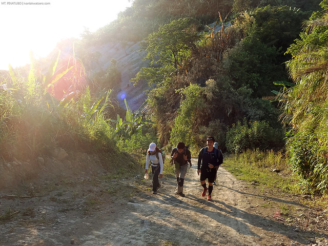
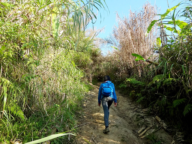
The trail was rather friendly during the first few hours of our hike. It was a long open dirt road with a seemingly never ending series of uphills and downhills. The sun hasn't pierced the dark sky just yet so I was kind of clueless how the environment looked like on the early parts of the trail.
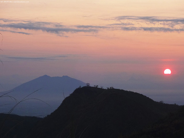 |
| Two hours into trekking, the sun finally showed up, revealing the distinct contour of Mt. Arayat. |
Mt. Pinatubo is bounded by three provinces. Zambales in the west, Tarlac in north-east, and Pampanga in south-east. I have tried twice the
touristy Capas trail in Tarlac where one gets the chance to ride a 4x4 vehicle over lahar field. Sapang Uwak is in Porac Pampanga so therefore we're exploring the southern face of Mt. Pinatubo.
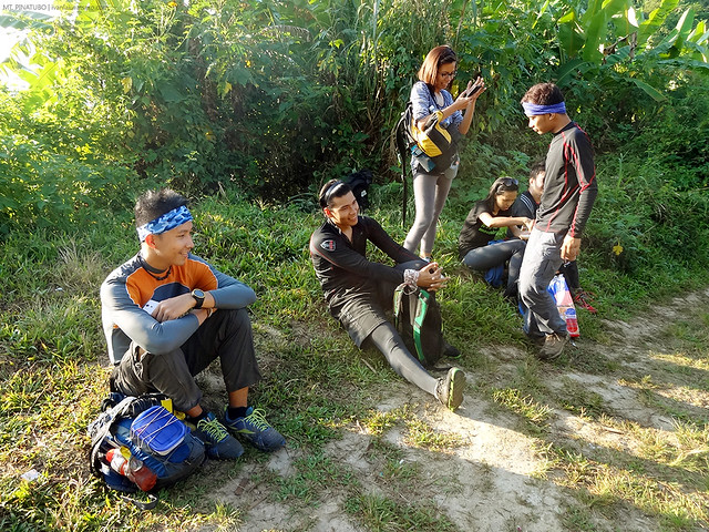
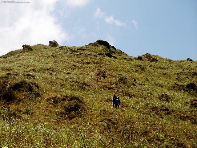
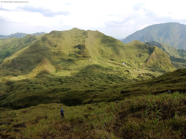
When the sun came out, I realized that our team of 18 was already divided into three subgroups. First group is the relaxed pacers who are eagerly marching forward despite being left behind, the second group are the mid pacers (where I belong) who are trying their best the catch the 3rd group, the third and last group are the fast pacers who actually ran the trail in fear that the mid pacers would catch up with them.
 |
| At first, petiks lang ang trek, pero habang tumatagal, nakakapagod na din. Walang katapusang ups and downs. |
The sun not only revealed the groups that formed among us, but also the vibrant flora that line the trail. Bushes of wild sunflower is perhaps the most remarkable.
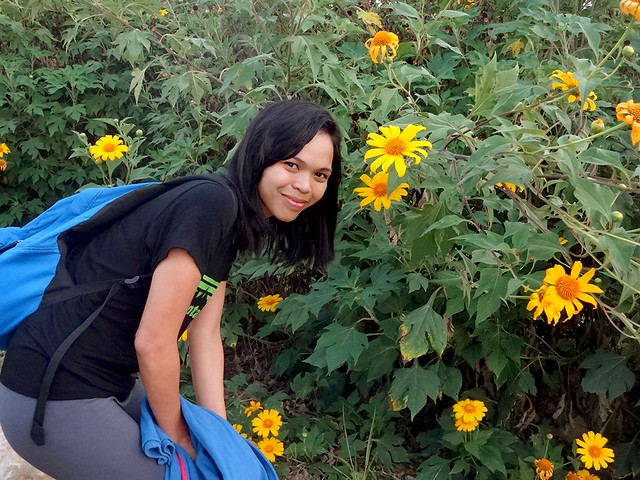 |
| Wild sunflower along the trail |
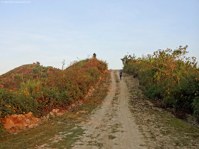 |
| As time goes by, the hike has become more arduous. Parang wala nang katapusan. |
Just like in any other mountain where the trail is open, the sun can become the worst enemy. Aahrrgh. It was only 6:30 AM when I checked the time but it feels like it's already noontime. Para akong natutunaw sa init. Buti na lang we've reached Miyamit Junction. Here, we sat on a shaded area and had a snack break.
Gutom na kasi kami! We haven't eaten our breakfast yet, umasa lang kami sa light snacks the entire time.
 |
| sandwich break para sa mga kumakalam ang sikmura |
We resumed our hike at 7 AM. A steep upward trail followed our 20 mins break. Parang naubos na kaagad yung naipong energy sa snack break namin sa junction.
 |
| Steep ascent past Miyamit Junction |
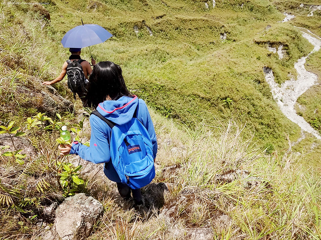
After the steep trail, we entered a much denser forest trail. I saw many banana trees and occasionally, we would meet aeta villagers along the way. Water is very scarce in the area. I think there's just one water source to be encountered. I only brought 3L of fluid, sana magkasya.
By 10 AM, hints that we're hiking an active volcano began to show up. The trail that was originally composed of brown compact soil begins to transform into grey course sandy surface. So as the vegetal cover, from dense green trees and banana plants, tall grasses became more common. Having been to a number of mountain that is
volcanic in nature, that environmental transition was quite familiar.
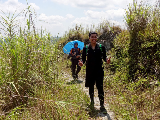 |
| grassland cover on sandy surface, senyales na malapit na kami sa volcanic crater. Senyales din na kelangan na magpayong kasi sobrang init na. |
 |
| feels like trekking on lahar field. Konti na lang, malapit na. |
Excited and expecting, I rushed towards the high ground. I was hoping that the crater summit was well within reach once I reach the top. So I ran.
Tumakbo ako kahit init na init at uhaw na uhaw. When I got there, however, I realized how far we're still from reaching our destination. What we saw was a valley separating the ground where we're standing and the likely crater summit. Amazingly, we saw the fast pacers group already at the top, probably chilling and celebrating their victory.
 |
| 10 x zoom. The fast pacers already chilling at the crater rim. |
We've been hiking for about 9 hrs now. Time was almost 12 noon and the crater rim was already within sight. We're still within the cut-off time. I forgot to mention, prior to our hike, we agreed to set a cut-off time for this ambitious climb. Anyone who fails to reach the crater rim by 2PM must stop and go back.
Buti na lang pasok na pasok pa kami sa banga.
Since it was almost noontime, we decided to move on and march down towards the valley so we can have our lunch there. To get down the valley, however, one must scramble down the very steep trail, which for me, was the most challenging part of the entire hike. It was so steep, probably 80 degrees. and there were no strong roots nor branches to cling on as we go down. Not to mention, the very lose ground.
 |
| Characterized by being sun-exposed and has very lose ground, this part
of the trail proved to be the most challenging part of the trek. |
We gave lunch a quick 30 mins when we reached the valley. There, we stayed in a shaded area beneath the bushes and branches. Again, I munched on a sandwich. That moment, I ate as much as I can for I know the final assault is waiting ahead of us.
 |
| Quick lunch break bago ratratin hanggang crater rim. |
The final ascent towards the peak rather far from easy. In fact, it reminded me so much of our scorching hike in Mt. Balingkilat. The sun was intense and draining, water was limited, and there's simply nothing we can do but keep marching forward.
Para na kaming zombie sa bagal ng kilos namin. Parang kada sampung hakbang, titigil kami at magpapahinga ng hanggang 3 minute. What can actually be done in just 30 minutes, we finished in about an hour. Along the way, we bumped into the fast pacers group who were already on their way back down.
Edi sila na.
 |
| konting tiis na lang! |
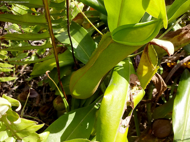 |
| spotted along the trail, pitcher plant |
 |
| sobrang init |
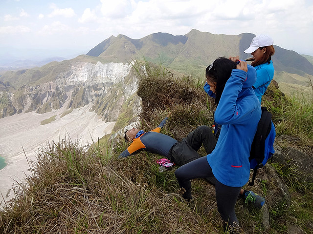
It was exactly 1:15 PM when our hardships finally paid off. As soon as I made my final step to the rim, lo and behold, the much coveted crater lake finally appeared on the horizon. For a moment, I was stunned.
Talagang natulala ako, namangha at nakatitig lang sa crater lake. In all honesty, that view of the Pinatubo lake from the crater rim of the volcano itself is one of the most amazing scenes I ever saw in my life. I was speechless.
Wala akong ibang nasabi kundi "wow."
 |
| At last, the peak of Sapang Uwak trail. |
Twice I have seen this lake when hiked the Mt. Pinatubo via the popular Capas trail, both offered an amazing feeling. For the third time, I am facing the same lake, but from a different perspective, yet still, it's astonishing as ever.
Walang kupas ang ganda.
 |
| Blessed to get a clearing we wished for. In a flash, napawi ang pagon namin. Believe me, mas nakakatulala ang view na yan sa personal. |
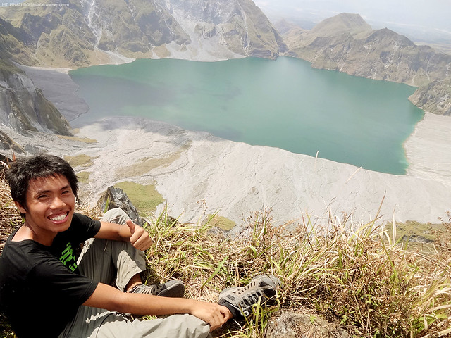 |
| toinks. Batang Lakwatsero sa Mt. Pinatubo. |
We stayed at the peak for a good one hour.
Yup, naka-ubos kami ng isang oras sa taas nang hindi namin namamalayan. We suddenly forgot that there's a time we need catch up.
Aarggh! Kelangan na pala namin bumaba. We left the summit at around 2:15 PM.
 |
| green valley as seen from Pinatubo crater. |
Descending the lengthy Sapang Uwak trail is another long and arduous story to tell. From around 2 in the afternoon, we trekked down continuously with very minimal breaks. It rained, we ran out of water, and dark night caught up with us. Some of us even managed to take a nap while trekking. Truly, a very tiring death march. So to make it short, we made it back to Sapang Uwak Village at around 7 in the evening, making this hike my longest dayhike to date. Gosh, 16+ hours of trekking, I think I've had enough hiking for the day, or maybe for the month.
I did not hike for a month after this long dayhike of Mt. Pinatubo. Indeed, Sapang Uwak dayhike is challenging.
____________________________________________________________________________
Another successful volcano adventure for Batang Lakwatsero. For more volcano adventures, check out the following links:

Wow, I should try this trail. who is the organizer> Thanks for the post if you are interested, for your future travels here in the Philippines you can check out our services at Travel Ventours we will be more than happy to assist you and maybe provide a discount. Thanks and God Bless! More Power!
ReplyDeleteHi Sir, may contact number po kayo para sa permit?
ReplyDeletehow much din po yung damage
ReplyDelete
ReplyDeleteHi Ivan,
My name is Kim of Jacaranda Travels I saw your blog while looking top travel bloggers in the Philippines.
Nice climbing at Mt.Pinatubo, you never give up even many hard trail in your travel trip.
I was hoping if you are interested for an interview that we will post on our business travel blog at www.jacarandatravels.com (facebok page at www.fb.com/jacarandatravels).
Thank you, hoping for your positive reply.
Kimberly-Tourist spots in the Philippines
jacaranda travels
jacarandatravels@gmail.com