Off the coast of the northeastern tip of Luzon, in the province of Cagayan, lies Palaui Island. It's an island people would visit for pristine beach, Batanes-like landscape, and a century old lighthouse. Without a doubt, it is a great place!
How great?
Well, dito lang naman gaganapin ang season 27 ng Survivor. That's right, the island has attracted the whole crew of the reality game show and they're now rolling season 27 of Survivor Series, how cool is that?
Haist, buti na lang napuntahan ko kagad ang Palaui Island bago isara para sa shooting ng Survivor. Yes, I was there last February, and I've seen and experienced for myself this piece of paradise.
________________________________________________________________________________
Sunday - February 24, 2013
Reaching for Palaui Island, as it is located in the extreme north of Luzon, is really a pain in the ass, and I mean literally. Can you imagine, a total of 15+ hours,
let me emphasize that,
15+ HOURS BUS RIDE from Manila just to experience this island. Well actually, you can cut the travel time shorter to about 5 hours only if and only if you're able to book a flight to Tuguegarao from Manila.
I would've done that kung hindi lang sobrang biglaan itong lakad na ito.
Anyway, here's what we had to endure just to get into the place:
At 3:00 PM of Saturday, Feb 23, me and my friend left Manila for Sta. Ana, Cagayan aboard Florida Bus (
take note that only Florida Bus has trips direct to Sta. Ana, Cagayan, bus leaves Sampaloc Terminal every 12nn and 3pm daily, fare is 600+). Through the provinces of Bulacan, Pampanga, Tarlac, Nueva Ecija, Nueva Vizcaya, and Isabela (grabe, pag-banggit pa lang sa mga probinsyang nadaanan strenuous na), we reached the extreme northeastern town of Sta. Ana, Cagayan at around 6 AM the following day. It was a long butt-numbing ride, really!
Pinakamahabang land travel ko ito so far.
Our goal that morning, upon alighting from the bus, was to meet our friends at Palaui Island who
came one day ahead of us (
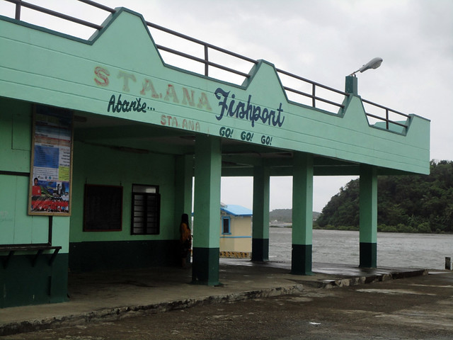
kung alam ko lang na matutuloy rin pala ako, dapat sumabay na ako sa kanila). From Sta. Ana market, where the bus dropped us, we traveled by trike (P20) to San Vicente port,
it was just a quick ride. We reached the port at around 6:30 AM, and were supposed to sail right away for Palaui Island. Unfortunately, the weather by that time was not permitting,
it was so gloomy and raining at Sta. Ana, thus we had to wait for another hour or so.
 |
| gloomy morning at Sta. Ana, Cagayan. Malakas ang alon, nakakatakot! |
 |
| Once at San Vicente Port, getting a boat for Palaui Island won't be a problem. The boatmen there are very well organized and they have standard rate for all the destinations in the area. There's also an environmental fee (P20) that you'll need to pay before proceeding to Palaui Island. |
It was only at 08:00 AM that we sailed to the island —
travel time was approximately forty minutes. Aah, that 40 minute wet and wild ride
, we're so drenched in rain and splashes while being rocked tremendously by the restless waves
, oh gosh, I'm glad we survived it.
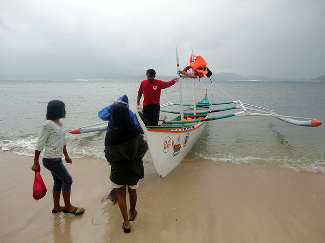 |
| We landed at around 08:40 AM. Woohoo, Palaui Island at last! |
The Quest for Cape Engaño Lighthouse
It is not the beach nor the Batanes-like landscape that lured me and made me travel 15+ hours. If you've been reading my blog way back 2011, then perhaps you know that I have given myself a quest to visit all the old Spanish lighthouses in the country (
please check out my Farola Page). Cape Engaño Lighthouse,
or Faro de Cabo Engaño, is among the lighthouses that I wish to visit.
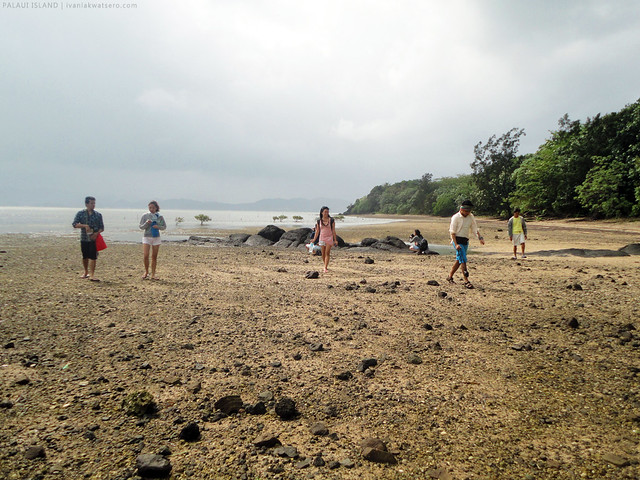
When we reached Palaui Island at around 08:40 AM, surprisingly, the rain subsided. "
Mukhang mapagbibigyan kami sa weather ah," I told myself. We probably just waited for 30 more minutes for our guides, then right away started marching to the lighthouse using the easy Lagunzad Trail.
 |
there are two trails leading to the lighthouse, the easier Lagunzad Trail and the more challenging Leonardo Trail.
Dahil rest muna ako sa mountaineering, we took the easier route. |
For a seasoned hiker, Lagunzad trail is just an easy, no-sweat-baby, walk in the park. Again, that's if you're a seasoned hiker. The trail is pretty much straight forward, composed of 50% walk-in-the-beach and another 50% walk-in-the-forest, there's no rugged steeps or whatsoever. Non-hikers will definitely enjoy the walk.
 |
| through this bridge |
 |
| then along the shoreline |
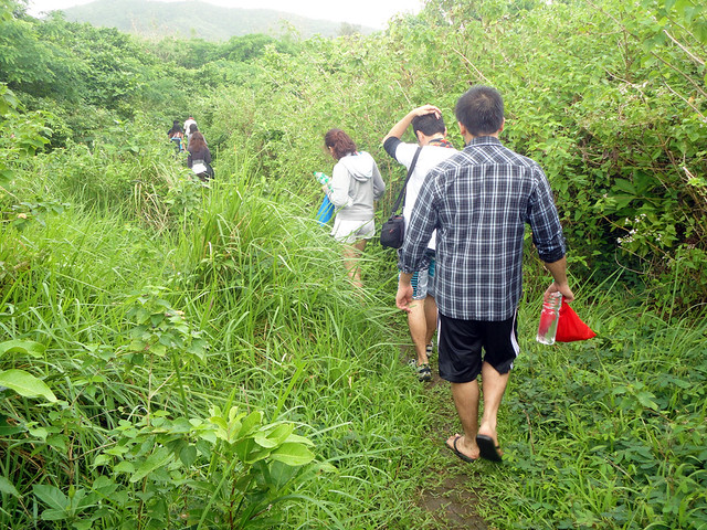 |
| then through the forest trails |
Sometimes, the trail would lead us to open grasslands and view points which will put you in halt and pose for some photo opps.
So when taking the Lagunzad trail, expect the usual 1.5 to 2 hours trek to extend an hour more.
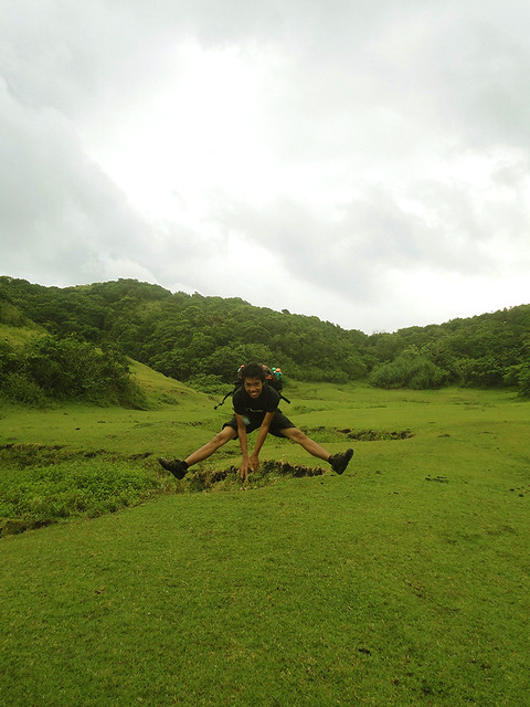 |
| jump-shot yeah! |
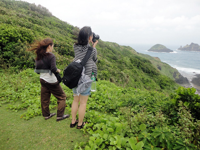 |
| the views were so scenic, mapapatigil talaga para mag piktyur-piktyur |
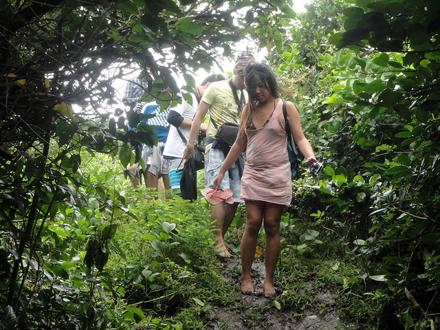 |
| some parts of the trail were really muddy, perhaps the only challenge in Lagunzad trail |
At 11:20 AM, after trekking for like 2 hours, we reached the green Cape Engaño. It was so beautiful and green, like a Teletubby land, will surely make you want to drop and roll over. Cape Engaño, by the way, is a grazing field, so expect some carabao sh*t scattered around.
Pero kahit ganun, maganda parin talaga.
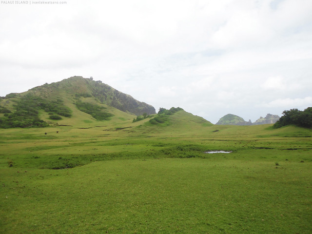 |
| green Cape Engaño, you will see on its highest point is the old Cape Engaño Lighthouse. |
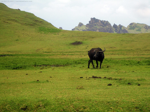 |
grazing carabao.
our verson of this. |
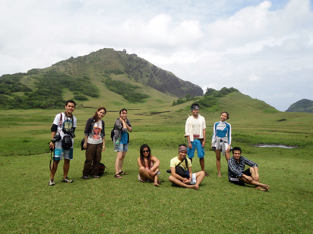 |
| group shot |
From Cape Engaño, the lighthouse would be just 30 mins away. We walked on a rocky beach then up a stone stairway. Walking up that stairway is probably the only tiring part of the whole trek, but that's ok 'cos the view was splendid.
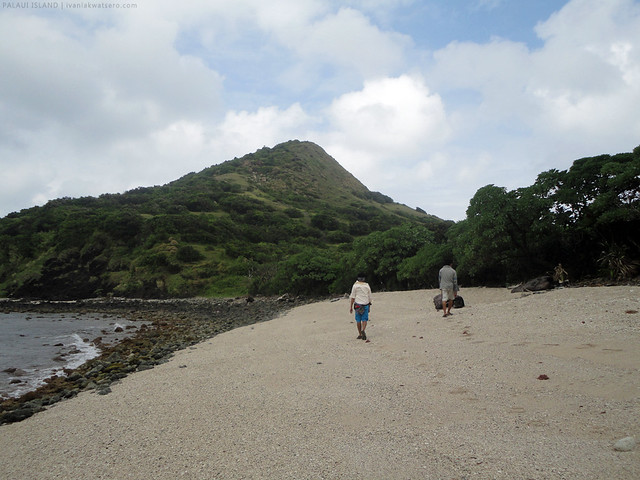 |
| rocky beach to the lighthouse! |
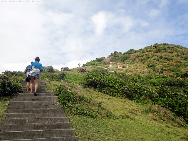 |
then up the stone stairway,
I think this is the only tiring part in the whole trek |
 |
| Pero magrereklamo ka pa ba kung ganito naman kaganda ang view? |
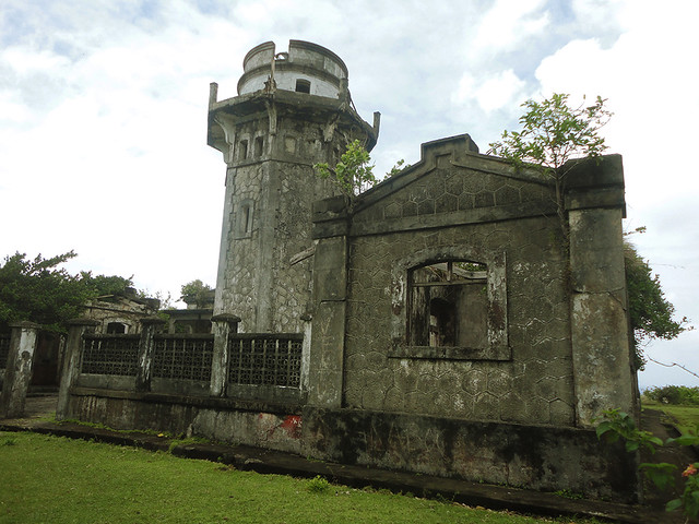
I felt great joy the moment I went face to face with the old
Faro de Cabo Engaño, the fifth in my
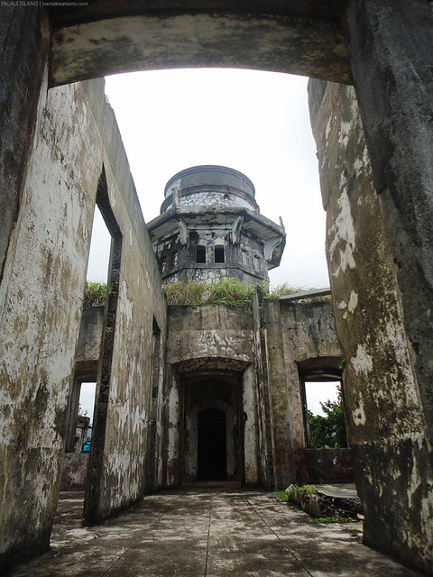
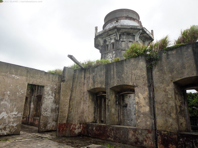
list! Like a kid who, for the first time, entered an amusement park, I was in great awe. I quickly roamed around to check the place, saw nothing but broken doors, fallen roofs, and rusty railings. Well obviously, just like all the other old farolas, it is in sorry state. The place is still very beautiful, nonetheless; the once glorious past can still, somehow, be seen.
 |
| Faro de Cabo Engaño |
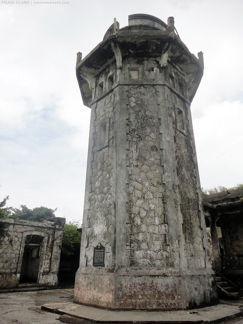 |
| Perhaps the only thing that the Philippine Coast Guard has been preserving in the area is the tower. That's right, the tower is still active and being utilized by moving ships in the sea. |
 |
| the lighthouse in ruins |
 |
| Inside the keeper's house. No roofs baby. |
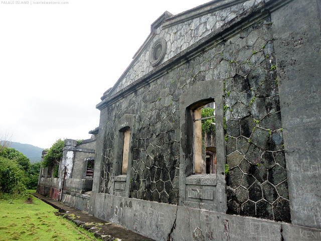 |
| actually, all the buildings other than the tower has no roofs. |
After taking photos of almost every angle of the lighthouse, we went at the back. Ahhh, it's a place that shouldn't be left out. The view there was simply breathtaking,
parang napunta ako sa ibang lugar na hindi ko alam.
 |
| don't you dare miss this view when in Palaui Island. Can make you speechless! |
It is painful to leave this island paradise, so beautiful and amazing. As much as we wanted to stay a bit much longer, we simply can't. At 1PM, we started to trek back to where we started.
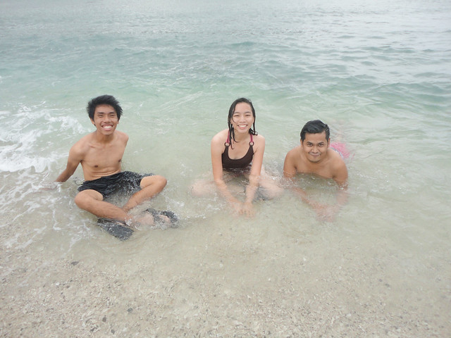 |
| Pero syempre, before we left the island, naligo muna kami sa dagat to make our island experience complete. yeah! |
_________________________________________________________________________________
I would like to thank Robbie of thetravellingdork.com for organizing this fun Palaui Island trip. Woohoo, another lighthouse has been crossed out on my bucket list.


ganda ng view...
ReplyDeletesarap puntahan nito sir ivan...
thanks for sharing your exploits...
puede b magcamping s island overnight?
ReplyDeletei think you need to secure DENR permit muna...not sure...ecology class kasi namin yun nung nagovernight kami at DENR area dyan.
Deletewow...ganda... :) nice guys!!!
ReplyDelete