
My conversation with Doc Gideon of Pinoy Mountaineer:
Doc Gid: Hey Ivan, naka-ilang bundok ka na?
Me: 29 na Doc, pang-30 yung Mabilog mamaya...
Doc: Andami na rin ha... teka, hulaan ko yang mountains mo... Of course Pulag, Tapulao, Arayat, Batulao.. (and so on...)
Me: Hehe...
Doc: But have you summitted all these mountains?
Me: Ughhmm... well yung Mt. Maculot, Rockies pa lang.
Doc: Ay, wala na... 28 mountains ka pa lang. haha
Me: Haha
Doc: Don't worry, Maculot Rockies is still a summit itself..
Me: [napa-isip ng matagal]
One week after that talk with Doc Gideon, I found myself walking the streets of Cuenca, Batangas, heading to Mt. Maculot, and my goal that day was to finish my unfinished business - traverse the mountain and reach its summit.
________________________________________________________________________________
Sunday - December 16, 2012
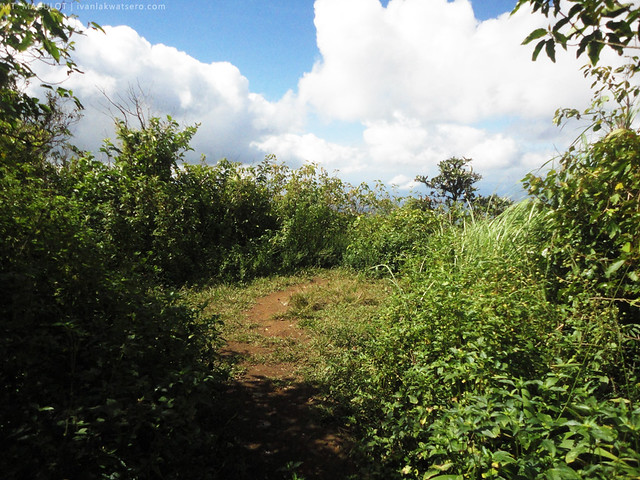
My goal in this hike, as I have mentioned, was to traverse Mt. Maculot and reach its summit, and I think the most convenient way of attaining this was to take the Grotto-Summit-Rockies traverse route. However, for some reason, the grotto jump-off was recently declared close by the authorities, and allowed only as an exit point for traverses.
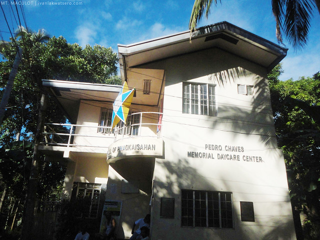
For everyone's info, there are 2 jump-offs for Mt. Maculot: the Rockies Jump-off and the Grotto Jump-off. Of course, as their name suggests, rockies jump-off leads to the Rockies while the grotto jump-off to Grotto. Both the rockies and the grotto are view decks of Mt. Maculot, and these two are connected by a single trail that traverses the mountain, passing through its summit.We headed straight to the grotto jump-off at Brgy. Pinagkaisahan as soon as we reached Cuenca, Batangas (umaasang baka payagang makapag-traverse).
 |
| Grotto jump-off. There's a P5 registration fee. |
Surprisingly, they let us pass the grotto for a traverse hike, hoorah. They just asked us if we have done the traverse, we said yes (buti na lang nakapag-traverse na yung kasama ko) and they let us pass.
 |
| hingal na kagad ako dito pa lang |
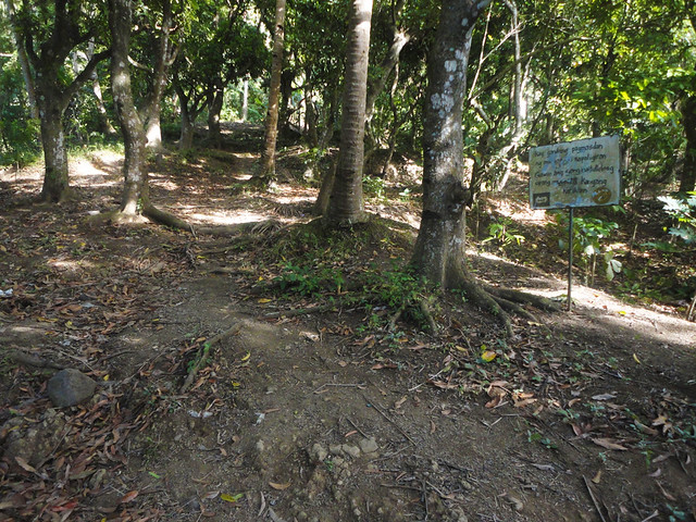
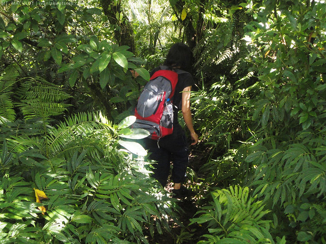
Following the ascending concrete road (sa simula pa lang medyo hiningal na ako), we soon reached the Stations of the Cross Trail. This trail is purely ascending, hihingalin ka sa pag-akyat. Of course there are stations of the cross along the way up until the grotto. What was good with this trail is that you'll know how close you are getting to the grotto, kelangan mo lang bilangin ang 14 stations na madadaanan mo. It took us about 30 mins to reach the grotto, andami namin kasing stopover, halos bawat station may rest.
 |
| trail starts here. |
 |
| you'll definitely know how close you are getting to the grotto by counting the stations of the cross |
 |
| most of the trail has this concrete stairway. |
 |
| and at the end of the stairway, there's this grotto. This place is a vantage point for viewing the plains and mountains of Batangas. |
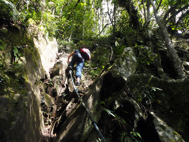 |
| the roped segment of the trail. Almost 90 degrees, may kataasan pero manageable naman. |
Not too far from the summit is a small campsite, we rested and had lunch there before continuing the trek.
 |
| summit at last. there's a view of Taal Lake, but not as good as the view from the Rockies |
What we did is we followed the most obvious trail, kasi yun ang sabi ng instinct ko at may nakita rin ako na trail signs. After 20 mins or so, the trail ended up on a high cliff, looks like my instinct failed me this time. I tried to scout the area, but to no avail. We had no choice but to return to the summit area, about 45 minutes were lost, tsk tsk.
 |
| nasan na ang tamang daan?? |
From that point, no more confusing trail was encountered. It was just a 20 minute descending trail, followed by a 10 minute talahiban trail.
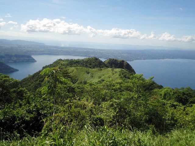 |
| Rockies viewed from the trail |
When we came out from the talahiban, the place suddenly looked familiar, aah we have reached Maculot campsite. Memories from my first hike at Maculot Rockies... sobrang sarap sa pakiramdam habang nag-flash back yung memory nung una kong inakyat ang rockies ng Maculot.
We rested only for about 10 minutes at the famous Maculot 7-11 then we rushed towards the rockies, sobrang excited ako.
 |
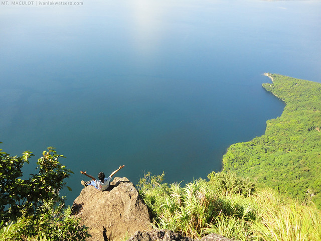 |
| after almost 12 months, nakabalik ako ulet sa Maculot rockies.. |
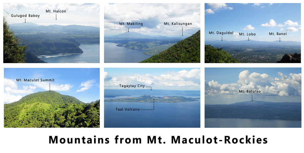 |
| here are the mountains I spotted from the rockies click on the photo to enlarge |
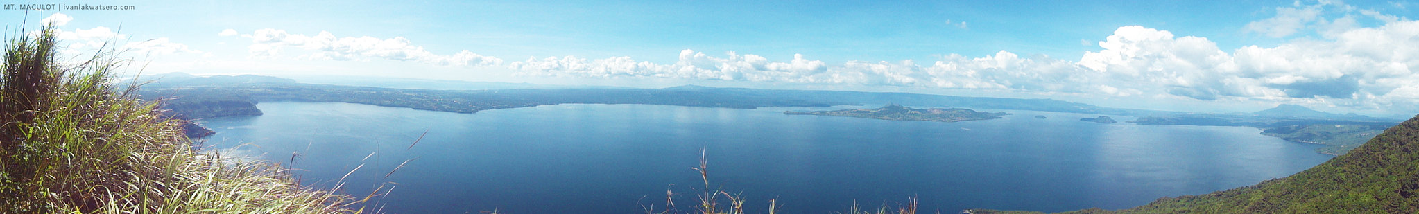 |
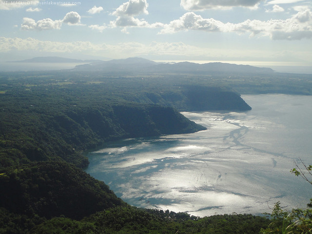
| of course, I also have a panoramic shot of Taal Lake as seen from the rockies click on the photo to enlarge |
Sitio Lumampao Again
We just can't get enough. As soon as we completed the traverse, Dawn and I had ourselves submit to yet another strenuous activity - the thousand stair step challenge to Sitio Lumampao. We stayed there until sunset, then again climbed up the stairs.
 |
| it may look easy, but I tell you, it will give you the challenge you are looking for |
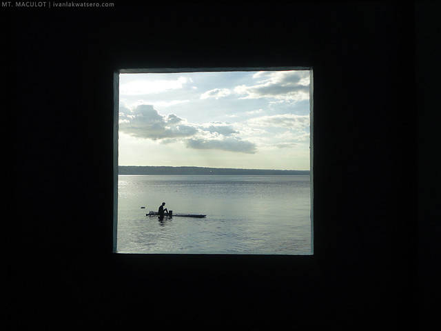 |
| closer look at Taal Lake |
________________________________________________________________________________
At last, I reached the summit of Mt. Maculot, big thanks to my hiking buddy, Dawn, for accompanying me in this fun climb.
You may also want to check out my first experience at Mt. Maculot: Mt. Maculot Rockies and a detailed itinerary for a dayhike: Rockies Dayhike itinerary.
"Doc: But have you summitted all these mountains?
ReplyDeleteMe: Ughhmm... well yung Mt. Maculot sa Rockies pa lang."
Confused me. You only submitted Mt. Maculot or is it the other way around? Hahaha!
Nway, nice article. Keep on climbing! :D
that conversation with doc gideon happened one week before this Mt. Maculot traverse..
Deletethanks for sharing the funny & witty side of sir Gid :)
ReplyDeleteganda ng mga pictures Ivan ah!
pag ready na si misis umakyat muli pasabit & pa-guide ha, hehehe, over a year na ako walang akyat, overpass to work lang ang daily exercise.
Happy New Year & I pray for your safety for an adventured-filled-to-be 2013, (nag-iisip ako name ng separate blog mo sa mountain, pa-contest ka nga sa FB friends mo & free transpo on a future climb sa winner, hehe!)
nice idea yang pa-contest na yan. hehe.. pero meron na akong naisip na name e, actually on the making na sya :)
Deletekakatuwa conversation niyo ni Doc. hahaha... yung mga ganitong view ang magpapaisip sa mga di umaakyat ng bundok at magtatanong "meron pala niyan sa pilipinas?" keep inspiring!
ReplyDeleteGanda talaga ng mga kuha mong piktyur Sir Ivan.Panalo!
ReplyDeleteSa pagbalik ko din jan sa maculot, nawa'y makapag traverse na din.
Nice post! Maraming Salamat sa lahat ng impormasyon!
ReplyDeleteSir how far is Sitio lumampao from the exit point nung traverse?
ReplyDeleteit's about 15 minutes walk from the "Mt. Maculot Rocky Rd" street sign, then a long stair down to sitio lumampao.
DeleteThanks
DeleteSir Ivan would you mind describing the traverse trail from grotto in details? Kaya po ba makita ung trail kahit walang guide? mahirap na maligaw hehe
ReplyDeletetrail from the grotto is easy to follow, medyo steep pero manageable naman.. hindi rin masukal... you'll encounter some branching trails at the summit area so you have to be keen at observing the right trail, meron naman mga trail sign. from there, wala nang ligaw papuntang rockies.
Deletehi sir ivan, wow! ikaw pala yung nakasalubong namin sa summit, nice meeting you sir! :) hehe! Nakakahiya kasi newbies pa lang kami sa age namin na to :) -edge & ron
ReplyDeleteyes naalala ko kay. haha :) nice meeting you too. nakakahiya, naligaw kami :P
DeleteHindi no, ang tapang nyo nga :) nanigurado lang kami since 1st time sa maculot kaya nagpaguide na kami, yun nga lang kids ang nakasama namin. Hehe! :)
DeleteSir, we are beginners and would like to try the Maculot traverse via Grotto. May guides ba kami makukuha sa grotto? Thanks!
ReplyDelete