Since we bypassed the summit of Mt. Cabuyao when we hiked
Mt. Sto. Tomas just a week ago (Oct. 6-7), one of my aims for this weekend Baguio Trip (Oct 13-14) was to reach the radars of Mt. Cabuyao. I just want to complete the so called "Twin Mountains" of Tuba, Benguet.
____________________________________________________________________________
Sunday - October 14, 2012
Both Mt. Sto. Tomas and Mt. Cabuyao share the same jump-off point at Green Valley Police Station. It is easily accessible either by car or jeepney (jeepney terminal to Green Valley is located near Hotel Veniz). But as for our group, we traveled by taxi (about 20 mins) from our hotel until the jump-off point. It was 6 o'clock in the morning when we arrived, and we commenced with the trek right away.
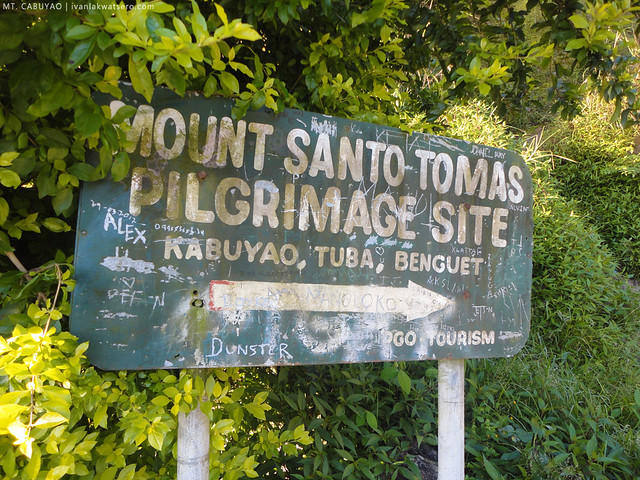
Following the concrete road, it led us to a trail head with a sign board: "Mt. Sto. Tomas Pilgrimage Site". We followed the ascending trail thinking that it will lead us to the summit right away. But after 20 minutes, we're back on a road.
 |
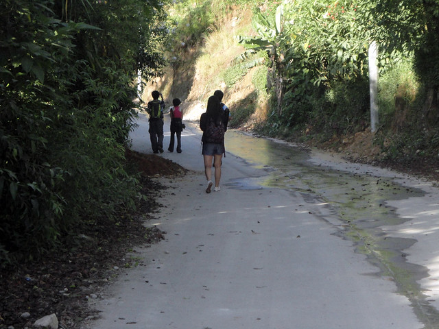
| Both Mt. Sto. Tomas and Mt. Cabuyao share the same jump-off point and road to their summits |
 |
| the ascending trail na kapag dineretso... |
 |
| ...will lead you again to the concrete road to summit |
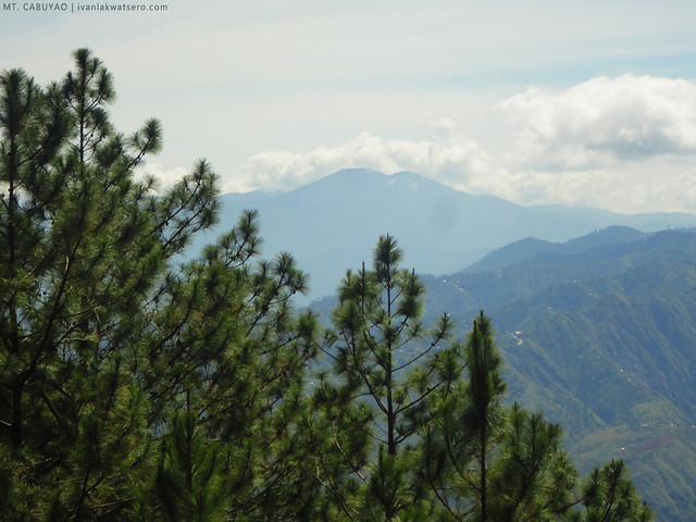
How else can I describe Mt. Cabuyao's trail (or should I say road) to
summit other than the words easy, paved, and gradually-ascending? It's
pretty much a newbie-friendly mountain but offers breathtaking view of
the adored Cordillera Mountain Range as well as the whole city of
Baguio.
 |
| Marcos Highway spotted from the road |
 |
| Good morning Baguio City! |
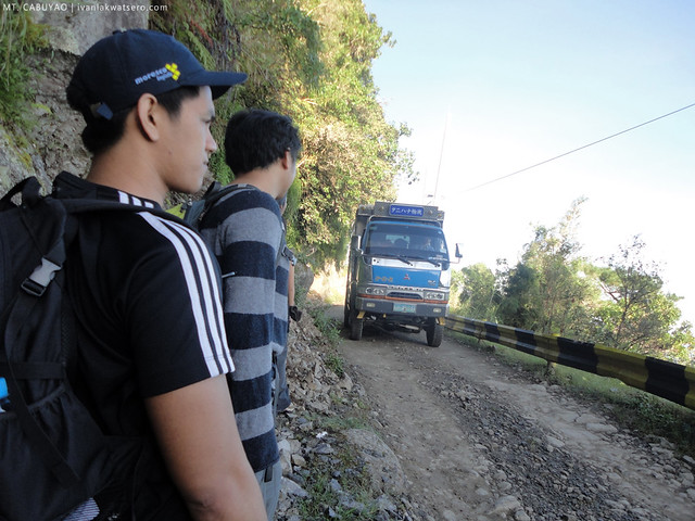 |
| there were truck coming from the summit. pwedeng pwede maki-hitch kung may masaktohan sa pagbaba. |
The radars were almost at our reach, probably just a few hundred meters above us, but there's no way we can get there faster aside from taking the long road (
wala na kasing shortcut trail to the radars). Along our way, we found a store slash videoke,
at syempre alam na kung ano ang ginawa namin... After finishing 4 songs (e.i. Stupid Love, Pusong Bato) we proceeded again with the hike.
 |
| there's the summit already, pero walang ibang daan kundi ang concrete road na mahaba. |
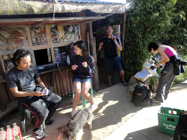 |
| videoke break. dito ko lang naappreciate yung kantang "Pusong Bato" |
But before we proceeded to the radars, our friend Emil showed us Mt. Sto. Tomas Water Reservoir - where most of the residents of Baguio City are getting their supply of precious H2O. Nothing really looked special with the place (we spent only 5 mins there) but it was still pleasing to the eyes.
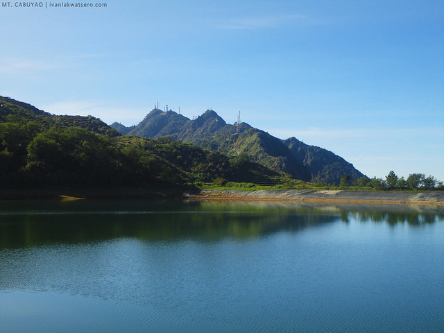 |
| Reservoir, with Mt. Sto Tomas summit at the background |
We continued with the trek, followed again the road until finally, we reached the radars at 08:25 AM. The radars were however gated, and getting inside was not possible. But still, I was fascinated by those huge facilities.
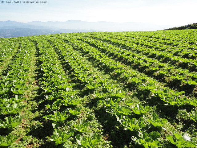 |
| there are also vegetable garden along the road to summit. Also, look at the background, it's Luzon 1-2-3. |
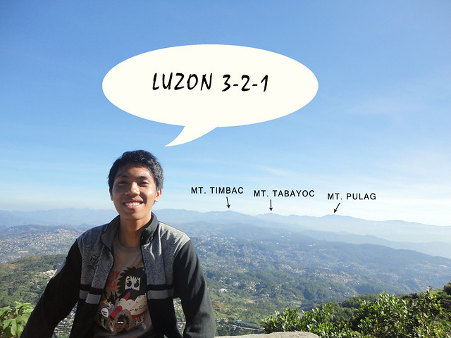 |
| three highest summits of Luzon, visible from the road of Mt. Cabuyao |
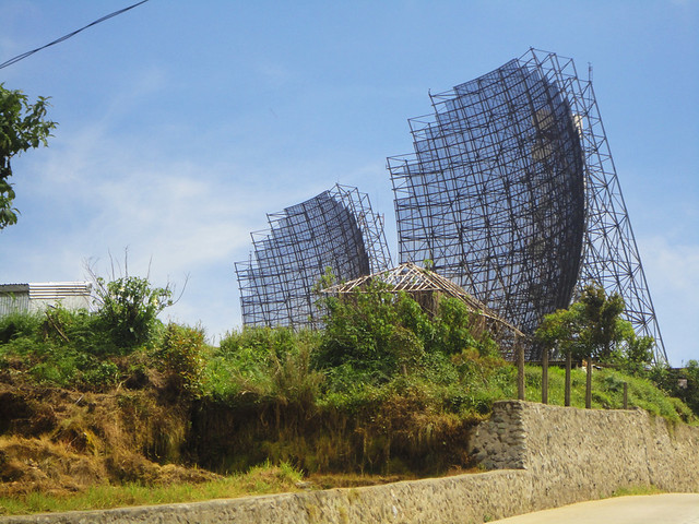 |
| here comes the radar summit. |
 |
| even closer to the radars... |
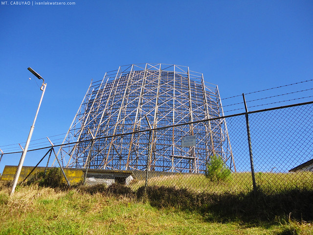 |
| but oops... bawal pumasok sa loob. |
Side Trip to Burial Cave
I thought, after seeing the radars up close, we will start heading down again back to the city. But Emil brought us to an unpopular but very interesting place in Mt. Cabuyao - a burial cave.
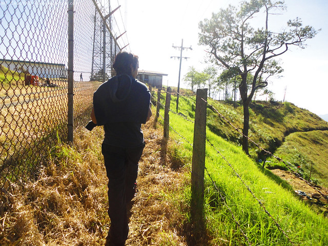 |
| trail to the other side of Mt. Cabuyao. nasa gilid lang ng gate.. |
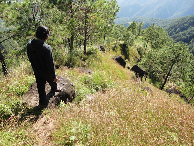
There's a trail on the side of the gates of the radar. We just followed it until we hit the traverse trail of Mt. Cabuyao to Kennon Road,
yup meron traverse trail ang Mt. Cabuyao papuntang Kennon Road. The trail was a bit steep, but the view there was astonishingly beautiful, very much like the trail of Mt. Ugo, full of pine trees.
 |
| Baguio City's non functional airport - Loakan Airport. Beside it (not seen in the photo) is the Philippine Military Academy. |
 |
| the trail that resembles Mt. Ugo. Sobrang dami ng pine trees |
 |
| Mt. Ugo is also visible from Mt. Cabuyao |
After about 30 minutes from the radar summit, we reached the burial cave. It was just a small cave, definitely not as grand and as big as the ones in Sagada, but still the cave looked very interesting.
 |
| the narrow entrance to the burial cave |
Inside, we found two coffins, bones were scattered and broken and I did not see any skull.
Mukhang napagnakawan na yung burial cave. Quite creepy inside, I must say.
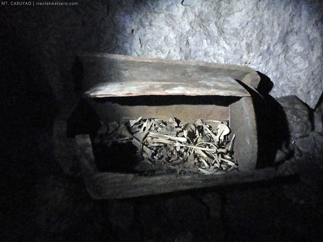 |
| on of the two coffins that we spotted. broken bones inside. |
 |
| matapos ang 10 minuto, nasa labasan na kami. |
It was a quick caving experience, we're done just after 10 minutes.
At paglabas namin sa other side ng cave, a grand pine forest made my day.
We decided to descend Mt. Cabuyao after the burial cave side trip, the time was around 11 am and we still need to check out on our hotel at 2 PM. So again, we took the road on our way down. We wanted to hitch but no truck came for us.
 |
| on our way down, we saw the fog creeping towards the summit. |
At 12:30 PM, after one hour, we're back again at the jump-off point. Woohoo. I'm done with my 25th mountain.
______________________________________________________________________
Successful dayhike on my 25th mountain.
Our adventure did not end in this mountain, after the morning hike, we visited Hydro Falls in the afternoon.

Noong bata ako, akala yung 2 radar sa ibabaw ng bundok e 2 malalaking aircon hehe! Akala ko tuloy yun ang dahilan kung bakit malamig sa Baguio NYE! :D
ReplyDeleteAnyway, congrats. Magyaya ka naman minsan, Master :D
wow!
ReplyDeleteHi! I might head there and try the trek with friends in March. Any tips? :) Oh, btw, where was that main photo taken? The one up top? It looks so amazing with that bed of clouds! Thanks! :)
ReplyDeletewell, Mt. Cabuyao is very accessible.. you can bring car up to the summit.. that cover photo is Mt. Pulag in Benguet.
Deletesir kung wala pong dalang sasakyan safe po ba na lakarin? deretso lang po ba yung trail? thanks po
ReplyDeleteyou may take a cab up to the foot of the mountain or until the local police station. From there, pwede nyo na pong sundan yung road hanggang sa summit.
DeleteMt. Cabuyao once had its natural beauty very different of what it is right now.. but @least u still appreciate it.. :-) i just hope that tourist and guest would pay respect of its natural facade that the beauty you saw today will be enjoyed by our great-great grand children.
ReplyDeleteSir Ivan I plan to hike there alone? will it be safe? is the trail very visible? do you know the trail going down to la presa(set of forevermore aired in ABS CBN)?
ReplyDeleteYes. safe naman. Madadaanan mo yung lapresa along the way. Kalsada yung dadaanan :)
DeleteNice blog sir Ivan, if you wanna go back and get inside the gated compound let me know. @justmeDennis
ReplyDelete