It was a big leap for me... after conquering several Southern-Tagalog Mountains, I headed north to experience my first Cordillera mountain.
On this splendid Mt. Ugo 2-day traverse from Nueva Vizcaya to Benguet, not only did we trek through a seemingly non-ending pine forest trail and savor a view of sea of clouds, we also got a chance to view Luzon's three highest peaks (aka Luzon 3-2-1) from its summit.
_________________________________________________________________________________
Day 1 - March 17, 2012
Kayapa at last, after a long butt-numbing ride from Manila - six long hours spent on the bus and another one hour on a chartered jeep - we reached this quaint town in Nueva Vizcaya (perstaym ko makaapak sa Nueva Vizcaya, ito ang pang-22nd province ko).
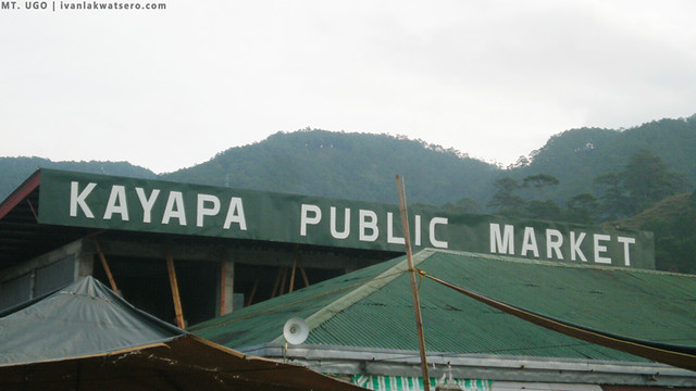 |
| the jump-off for the 2-day climb. |
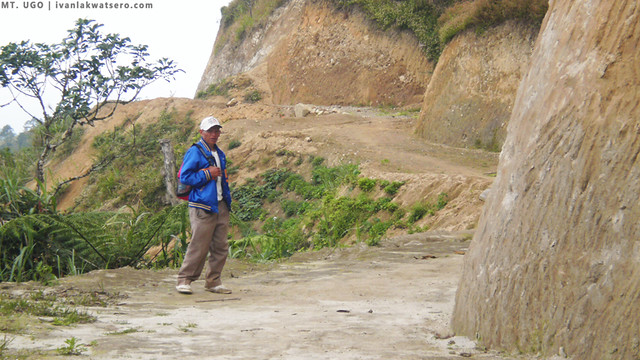
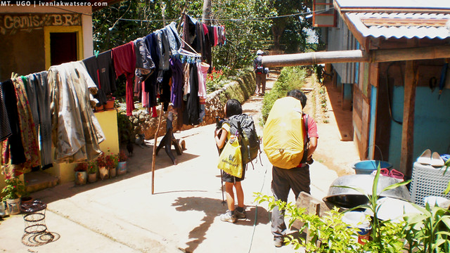
We arrived just right on time, it was only 06:45 am and the people of Kayapa were just starting with their daily lives. Our guide, kuya Bernard, welcomed us and led us to the registration area at the local police office. After listing our names at their logbook (there's no registration fee), our 2-day traverse commenced.
I was really ecstatic thinking that I'll soon be conquering my first Cordillera mountain. Sea of clouds, pine trees, chilly breeze... all of these were playing inside my mind.
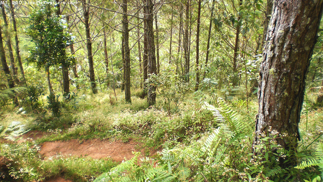
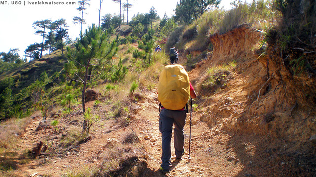
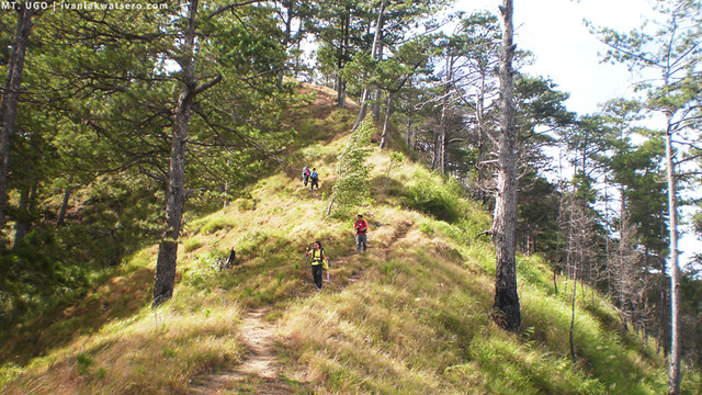
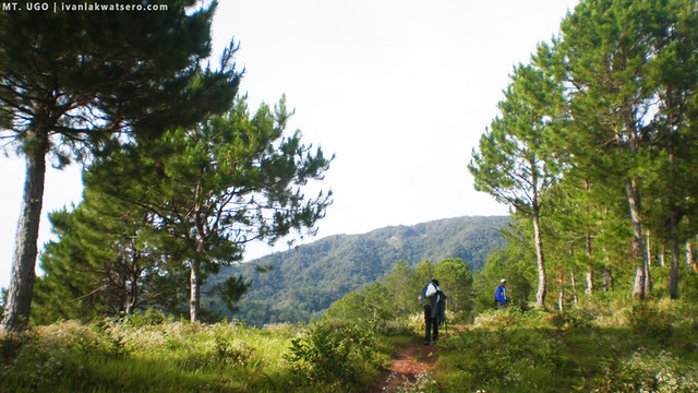
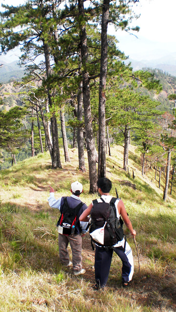
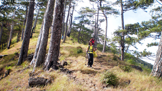
I think it was the starting trail that challenged us the most throughout the whole 2-day traverse. It's a two-hour steep assault towards Indupit, the first village you'd encounter along the trail. We had more than 3 rests, and we're panting as if there's no tomorrow. But despite that welcoming challenge, our eyes were fed with awesome sceneries of pine tree forests, bunching tree-like ferns, and various wild flowers. According to kuya Bernard, there's another trail along a mossy forest which would also lead us to Indupit Village, however the locals there demand a fee.
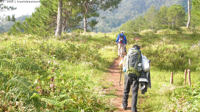 |
| the beautiful trail of Mt. Ugo |
 |
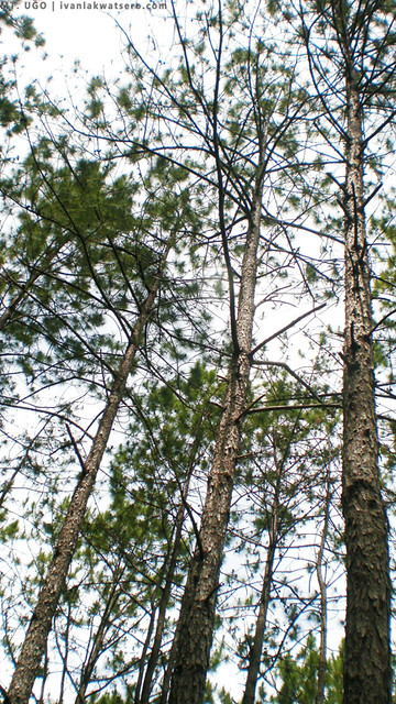
| pine trees are everywhere |
 |
| Kuya Bernard waiting for us |
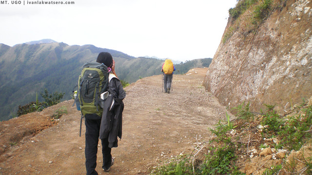
Around 09:30 AM, we arrived at Indupit Village. We rested there while looking at the clouded summit of Mt. Pulag. The temperature here made me shiver, it was really cold (wala pa kami sa summit pero nilalamig na ako ng sobra). After 30 minutes of rest, we resumed the trek towards the second village, which is Domolpos. But Kuya Bernard suggested the shorter way to Mt. Ugo's summit - via Ansipsip Shed (20 minutes shorter) - which will no longer require us to pass by the village of Domolpos. Since we wanted to get into the summit the earliest possible, we decided to just take this shorter trail that kuya Bernard suggested.
The trail beyond Indupit village was easy, just flat ground carved on the side of the mountains. Dane even said that it resembles Mt. Pulag's trails: the easy flat trail resembles the Ambangeg trail and the surrounding views were like Akiki's. I haven't been to Pulag, my dream mountain in Luzon (sana maakyat ko na siya soon).
 |
| this part was known as the Indupit-Ansipsip trail |
 |
| and it's getting wider because of the mayor's project |
 |
| as in wider |
 |
| we passed by the summit of Mt. Samiento |
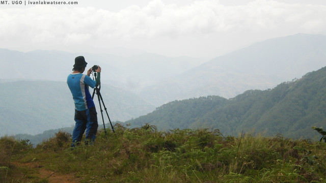 |
Sir Bryan doing his photography.
Mt. Ugo's trail was indeed very picturesque |
 |
| the splitting trail, turn right to Domolpos, left to Ansipsip Shed |
By 11:45 AM, we reached Ansipsip shed. There, a perfect view of Mt. Ugo appeared before us. Since it was lunch time already we stopped there to finally grant our hungry stomachs' little request.
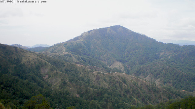 |
| Mt. Ugo overlooking at us |
 |
| My lunch for the day, Jollibeee chicken (c/o Sir Bryan Cuesta) + tuna paella. ang healthy no? |
Everyone seemed to be very sleepy after the lunch, so we took a few minutes to get a quick nap inside the shed. An hour was spent at the Ansipsip shed. After regaining the energy we needed, we continued the trek which according to Kuya Bernard was about 3 hours more.
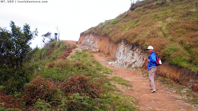
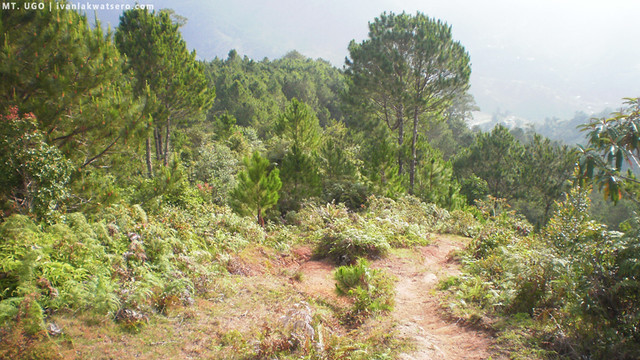
The trail still runs flat on the side of the mountain, then it slowly became a steep (the ground was loose rocks so be careful) as we near the next water source.
Mt. Ugo's summit was almost at our reach by 03:00 PM, just less than an hour away. The trail was steep again, similar to the challenging trail to Indupit Village, and the sun was striking at his best. Everytime we were stopping to take 2-minute rest, I would sit on the ground, drop my bag and gulp water in large amounts, truly I was tired already. It was the view of Mt. Ugo's summit that powered me up to continue the trek. I was getting closer to my first Cordillera mountain's summit.
 |
| nearing the summit |
 |
| getting ready for the final assualt |
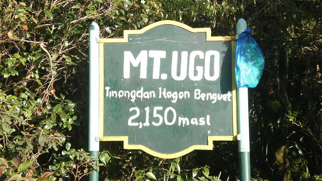
Finally at 03:45 in the afternoon, I summited my first Cordillera mountain, I summited Mt. Ugo, yehey! I was standing 2,100+ meters above sea level. It was a big leap for me, from the mountains of Southern-Tagalog, I moved up to the Cordilleras to conquer my highest summit as of yet.
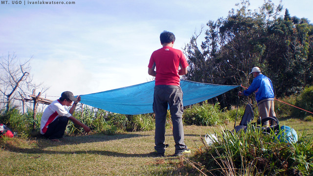
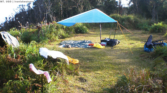
There's a wide campsite at the summit (probably more than 15 tents would fit side by side at the same time). But only 2 tents were accommodated that day. No one was there but us, we own the mountain!
Around 4:30 PM, the temperature was beginning to drop, clouds were starting to accumulate around us, hence we (I mean they) started to put up the camp.
 |
| ang aming silong c/o Dane |
 |
| because we own the summit |
But it seems that not only us got tired that day, the sun soon succumbed to darkness.
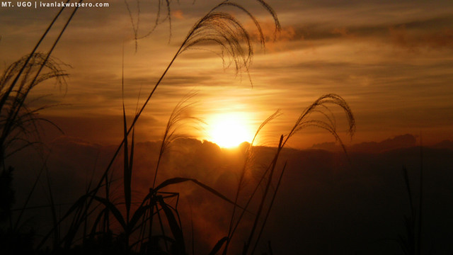 |
| lovely sunset at the summit |
Dinner time... Agnes prepared a sinigang na baboy meal for everyone (now I know 2 mountain camping recipes) while sir Bryan cooked the rice. Me, well I'm still a great spectator. Talagang may sakit ako na hindi pagtulong pagdating sa camping, unless orders were given (I should really start working out on this one). We dined with the "sinigang na baboy" still hot from the stove while being watched by numerous twinkling stars above us.
At 7:00 pm, the temp was excruciatingly cold. My body was shivering from head to toe. I only have one jacket and 2 layers of socks protecting me against the cold (I forgot to pack my other jackets, geez). Before I froze to death, I wrapped myself with trash bag (yung black na plastic) and gulped some red wine (
nako pag-iipunan ko talaga ang maraming wool jacket, ayoko nang ginawin ulit). It was about 8 in the evening when we decided to call it a day.
Day 2 - March 18, 2012
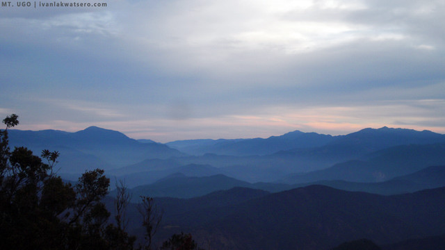
I woke up as early as 5:30 am just before the day breaks. I was excited to see the sea of clouds so I went outside the tent, but it was still very dark and extremely cold. I jogged around and did jumping-jacks to battle the early morning chills.
I waited a few minutes more then vwalla, the sea of clouds finally showed up. Dane soon joined me watching the sea of clouds. Awesome! Then when the horizon cleared a bit, Luzon's three highest summits appeared before our eyes. Dubbed as the Luzon 3-2-1, Mts. Timbac, Tabayoc and Pulag are visible from Mt. Ugo's summit. Awesome again!
 |
| sea of clouds in the early morning |
 |
| Luzon 3-2-1. Mts. Timbac, Tabayoc and Pulag |
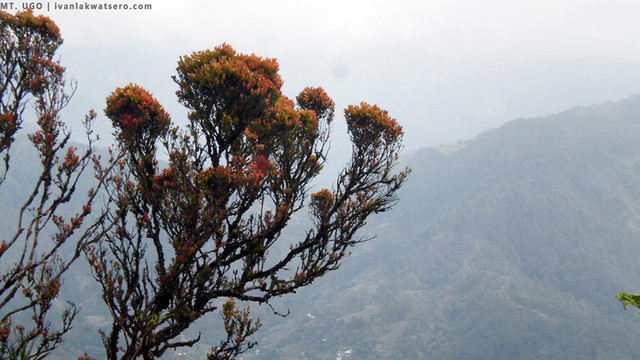
We also visited the summit point where a marker stands. The Mayor of Kayapa posted there a letter addressed to the mountaineers requesting them to pray for the souls of the people who lost their lives in the plane crash of 1987 which took place at that mountain. It is said that the trails of Mt. Ugo was made during the search of the crash site. What a grim story.
 |
the summit marker
the blue plastic bag contains the mayor's prayer request. |
Time flew fast, our stay at Mt. Ugo's summit has come to an end. As soon as we finished consuming the breakfast prepared by Agnes, we began breaking the camp and packing our things. By 9:00 AM, we started the long descent to the Benguet side of Mt. Ugo.
It was an endless trail on a beautiful pine forest. Distant peaks of several cordillera mountains such as Mts. Sto. Tomas, Cabuyao and Kibungan were viewed from the trail. Even the populous city of Baguio and La Trinidad are visible from the trail as we were trekking down. San Roque Dam was seen as well..
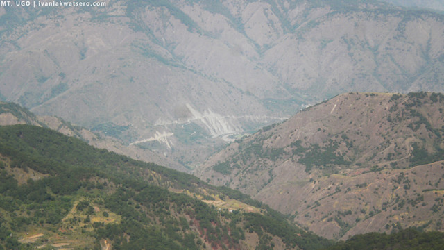 |
| peeking at the center is the San Roque Dam |
 |
| down trekking along a beautiful pine forest trail |
 |
| tall pine trees gave us shade |
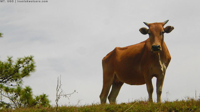
Flocks of grazing cows appeared to us from time to time. They were numerous on the Benguet-bound trail, as well as their shit. Kuya Bernard would just shoo them away like a dog.
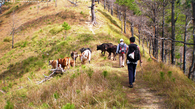 |
| cow encounter |
 |
| pang advertisement ng corned beef |
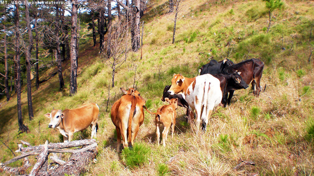 |
| more cows |
Also along the trail, we encountered several remnants of the timber industry that flourished way back to the pre-war American era. Huge rusty pulleys as well as log slides that were all used for transporting the logs are still present on the area near the village of Lusod (the first village to encounter during descent). Kuya Bernard even told us that the American saw millers buried their huge equipment somewhere on the foot of the mountain during the outbreak of world war 2. They hid every equipment used in the lumber industry so the Japs won't be able to use them.
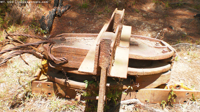 |
| remnant of the pass lumber industry - pulley for cable transportation of the lumbers |
At around 12 noon, our group reached Lusod. It was lunch time so we again stopped there to eat. We spent an hour at this quiet village before continuing our down trek.
 |
| at Lusod Village, there were no people around because everyone was out for the Sunday mass |
It was really hot that day, as if we're no longer in Benguet. All we want was to reach Itogon as soon as possible so we could take a refreshing bath. We followed the trail, even ran it when Kuya Bernard started to speed up. But he was fast, we weren't able to catch up with him.
I reached my limit when we reached the 2.5 KM marker. My knees were shaking already. Dane, Agnes, and Ron along with Kuya Bernard were far ahead of me. While Sir Bryan and the porter guy were also far behind me because they did not run with us. I was alone, almost crawled on the trail. So I decided to sit on the side for about 10 minutes before continuing the trek. Thank God I caught up with Kuya Bernard
et al near the 1.5 KM marker.
I was awed by the view that emerged from the slopes, a river. It was the great Agno River that amazed me and swept my weariness.
 |
| view of Agno river beside the Kawayan Village |
From the 1.5 KM marker, loose rocks composed the trail. Running over it can be suicidal so I just walked pretty slowly and cautiously. After 10 minutes, I reached the Kawayan Village. Dane and others were already resting in front of a sari-sari store. They bought 3 bottles of 1.5 L softdrinks and we all consumed it in just a matter of few minutes. Those ice cold soft drinks were the best, it's rejuvinating.
We've completed the traverse, but to formally end this climb, we must head to Brgy. Tinongdan, Itogon, Benguet and register there. We then crossed the great Agno River via a hanging bridge known as the "Petican-Animal Bridge". This hanging bridge has the best view among all the hanging bridges I ever crossed.
 |
| the great Agno River. Magnifique |
 |
| Petican-Animal Bridge |
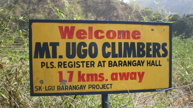
We met our chartered van at the Welcome Marker, which then brought us to Brgy. Tinongdan's barangay hall. We paid P100.00 as a registration fee, quite expensive but that will allow us the take a bath and get a climb certificate.
 |
| to complete the traverse climb, we registered here |
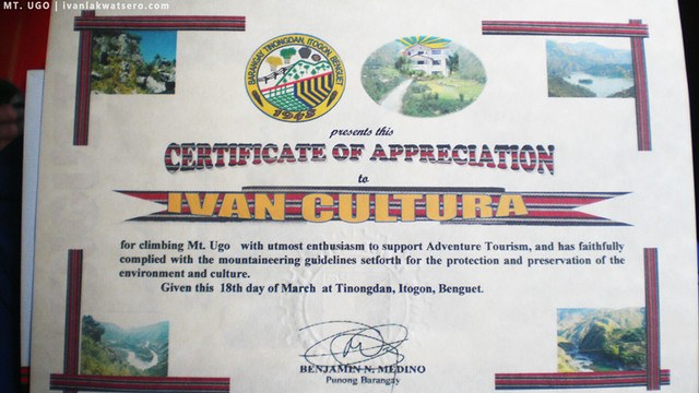 |
| and I got my first climb certificate. yey! |
Yey, the 2-day traverse paid off. We had a wonderful, memorable climb, one of my bests actually. Thanks to Dane and Agnes of
Tramping Philippines for letting me join this climb, I really had a great time with them and their friends, Bryan and Ron, 'til our next climb guys.
.


Alam mo, ni minsan di kita nakitang uminmom ng tubig habang gumagalaw. hahaha. meron kang sikret drinking technique. haha. ganda talaga ng Mt. Ugo. eto ung isa sa mga bundok na mamimiss mo talaga e. hwahayyy.
ReplyDeletehaha.. tinitipid ko kasi lagi ang tubig ko.. ayaw ko kasi nagbibitbit ng maraming tubig, mabigat e.
DeleteSir Bryan. hehe. ganun na talaga katanda si bryan. bwahhahaha.
DeleteButi nga di umulan lalo na nung gabi kundi super lamig nanaman nun. hehe. next time ibang recipe naman yung gagawin ko. natutunan ko lang din yung sinigang sa Lakay e. hehe.
oo nga.. blessed tlga yung climb natin.
Deletehaha sori naman... once ko pa lang kasi sya nakasama kaya may "sir" pa sa pangalan.
Ang ganda nung lugar na may caption -'down trekking along a beautiful pine forest trail' ... Sana maka-akyat na ulet ako ng mountain ulet soon...
ReplyDeletehardcore ka na! the trail looks unending pero tama ka, view palang at experience sa bundok - fulfilled ka na. congrats! im looking forward to see you, patingin ng nagbago sa body built mo. for sure nag-improve! hehe
ReplyDeletenako ate chyng, payatot parin ako as ever. yung legs ko lang ang medyo nag-improve. wala pa rin laman ang upper body ko. kelangan ko na mag-workout at mag-gain ng weight.
Deletenakaka lose weight talaga ang climbing...sabi ng officemates ko pumayat daw ako after my pinatubo and G2.
DeleteAstig tong bundok na ito, Ivan. Aakyatin ko siya balang araw. Congrats for your another conquered mountain.
ReplyDeletetara.. akyat ulit tayo soon. miss ko na kayo. :)
DeleteIniinvite ako ng friend ko mag Ugo pero di pa natuloy, malamig ba sa madaling araw? haha! un talaga un takot ko eh..at yung trail xempre... :p ganda nga ng view sulit ang hirap kung sakali.
ReplyDeletemaganda sa Mt. Ugo.. tama lang yung trail, siguro 60% flat lang yung dinadaanan.. mahaba lang tlga yung trek.
Deleteand yes, malamig sa summit.
dang! *inggit! i was planning an Ugo (via Baguio-N.V) but because of that knee injury-accident in Maculot kept me fairly grounded... and i hate it hahaha
ReplyDeleteCan i ask if you have any idea what time the *if any of the public transportation there? Or can i have the number of Kuya Bernard so that i can also ask him and the guiding rates. Thanks!
meron atang public transpo but it will delay your climb for few housr.. hndi ko pa nagagawa yung info post ko so I suggest that you visit Tramping Philippines: http://www.trampingphilippines.com/2012/03/mt-ugo-2-day-kayapa-itogon-traverse_26.html
Deletesila yung mga kasama ko diyan sa Ugo.. nandyan na lahat ng contacts ang itinerary.
well I'm still a great spectator - hindi ka nagiisa!
ReplyDeletemagkano ang expenses each?
ReplyDeleteyung porter po magkano per day?
2400 ang budget namin bawat isa.. 400/day ang rate ng porter
DeleteI agree sir Ivan, Ugo is one of the most scenic mountains that I've climbed so far. Been there twice already (both Kayapa-Itogon and reverse) pero I wouldn't pass up the opportunity to climb it again, ang ganda ganda kasi. :D
ReplyDeleteang ganda talaga ng mga bundok sa Cordillera!
ReplyDeleteGood morning po Sir Ivan.. ask ko lang po kung san po makakakuha ng contact for chartered jeep? Pagdating po ba sa Aritao or Bambang, Nueva Vizcaya via bus, don po ba magaabang yung driver ng irerent na jeep going to Kayapa? tsaka amgkano po kaya ang rate? salamat po ng marami.. =)
ReplyDeleteGood day po Sir Ivan.. Ask ko lang po kung meron kayong contact for chartered jeep from Aritao or Bambang, Nueva Vizcaya going to Kayapa? magkano po kaya ang rate? balak din po kasi namin mag climb ng Mt. Ugo. I hope to hear from you soon. Thanks
ReplyDeleteHello po. Ask ko lang po sana if anu po ung mga schedule ng hike sa mount ugo.and sino po pwdng contact in case gusto ko po umakyat.thanks po
ReplyDelete